Mt. Ryuo Course
Climb through history, and look across the land where Japan began.
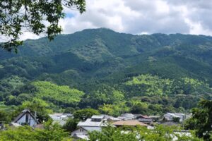
A low mountain in southern Tenri City with a wide view of the Nara Basin, Mt. Ryuo has long been a popular destination thanks to its rich history and accessibility. Named after the dragon deity of water, it is thought to have been a precious place for local farmers who treasured the water gathered on this mountain. Its rich history includes a cluster of kofun tombs built in the 7th and 8th centuries, and a 16th century castle that was once located at its summit, as well as places like Chogakuji Temple and the Tomb of Emperor Sujin at its base.
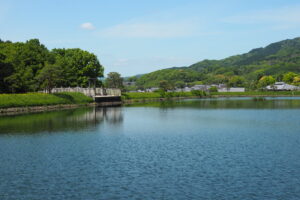
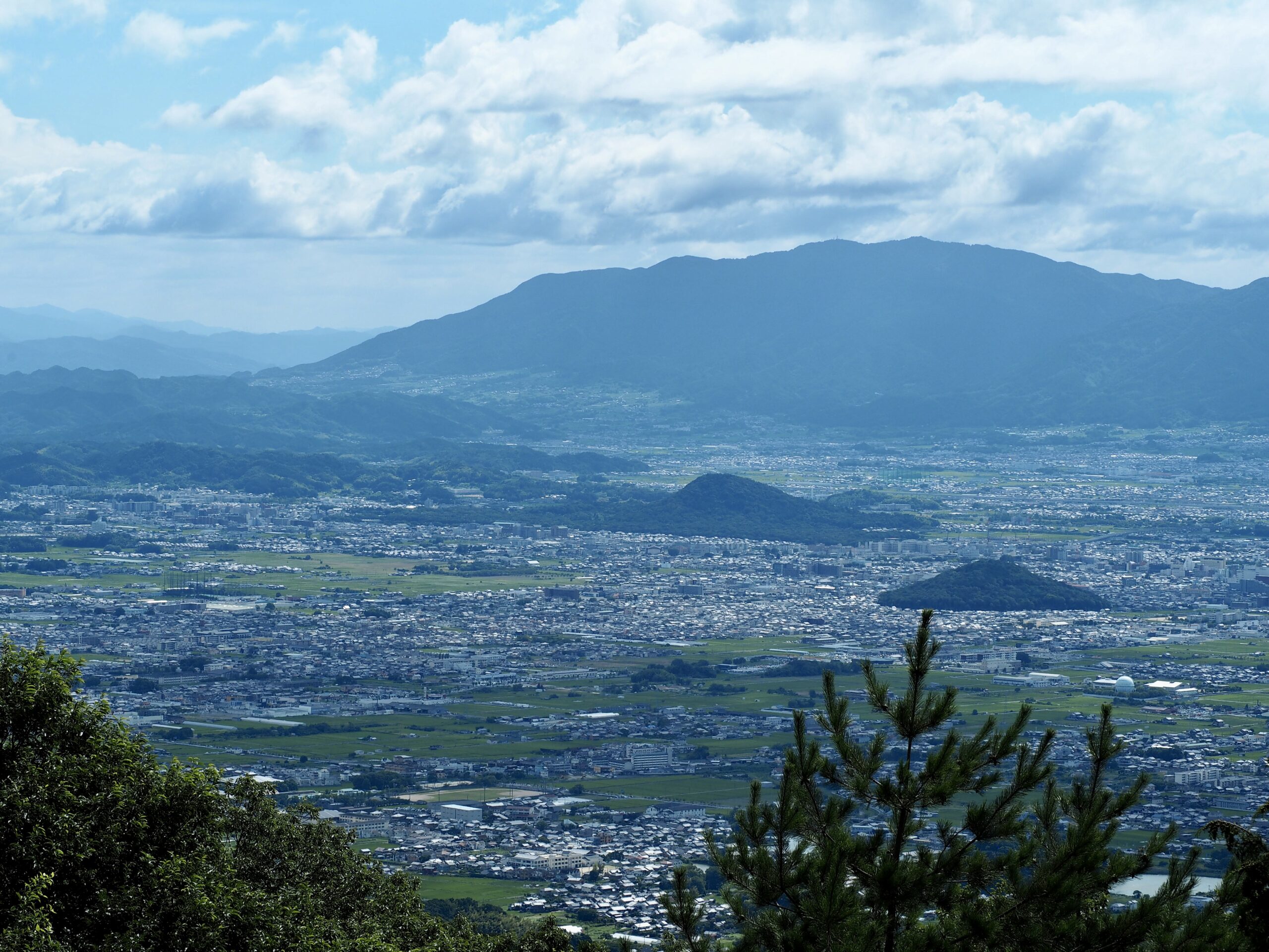
From the summit, we can see the line of mountains on the western side of the Nara Basin. Just beyond the mountains are the Osaka Bay, and cities like Osaka and Kobe. If the skies are particularly clear, we can sometimes see the Akashi Kaikyo Bridge, once the longest suspension bridge in the world. Just below us to our left, we can see the Yamato Sanzan, the three smaller mountains that were one of the stages of Japan’s beginnings. In addition to its history and great view of Nara, Mt. Ryuo is a mountain that both beginners and experienced mountain climbers can enjoy. You do not need any ropes or special equipment, but we recommend wearing shoes and clothing suitable hiking on a mountain.
Course Overview
This is a course that takes us from JR Yanagimoto Station, up the Chogakuji Route to the summit of Mt. Ryuo, down the Sujin Route, and back to the train station. The Chogakuji Route begins from just in front of Chogakuji Temple, and 9th century Shingon Buddhist temple. We walk a gradual incline past persimmon trees, gardens, and a few houses before arriving at the mountain path. The dirt path continues up the mountain, with some steep places. About two-thirds of the way up is a small side path that leads to the Okunoin of Chogakuji Temple, a detached part of the temple with a stone carving of Acala (Fudo Myo-oh in Japanese).
This course takes us to the remains of the southern castle on the summit. There is no longer a castle there, and just a few stone steps and foundation stones from the days of the castle still remain.
After enjoying the great view of the Nara Basin, western mountains, and Yamato Sanzan mountains, this course takes us down the Sujin Route. We walk through the Mt. Ryuo Tomb cluster, which has over 600 kofun tombs dug into the slope of the mountain. As we descend, there are parts of the path where we may need to step on large rocks, or through puddles and wet areas. The path gradually flattens out, and we eventually reach the Yamanobe-no-Michi path. From there, the course takes us along the south side of the Tomb of Emperor Sujin, and back to JR Yanagimoto Station.
There are a few different routes to the summit of Mt. Ryuo, and this course that allows you to hike two of them while enjoying the mountain’s history.